


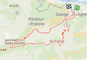

4 km | 9.6 km-effort


User


FREE GPS app for hiking
 SityTrail
IGN / Geographical institutes
SityTrail World
The world is yours!
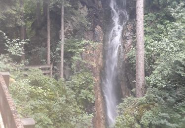
Trail Walking of 6.2 km to be discovered at Trentino-Alto Adige/Südtirol, South Tyrol, Ratschings - Racines. This trail is proposed by pidjam.
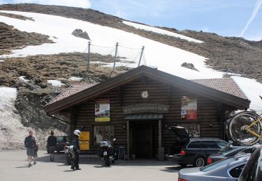
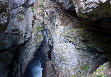
La montée dans les gorges est très belle (chemin payant) , avec la descente par le chemin "3" . Le point de départ est l'arrêt de bus (312 et 319).
On foot
On foot
On foot
On foot

On foot
On foot
On foot
On foot
Walking